East Central Florida Regional Resilience Collaborative EPA Climate Pollution Reduction Grant
Community Outreach Survey
Share your thoughts on the most important challenges and needs in your community!
The East Central Florida Regional Resilience Collaborative, a program of the East Central Florida Regional Planning Council, received federal funding to lead the development of a regional greenhouse gas [GHG] reduction plan covering the Kissimmee-Orlando-Sanford MSA. The Plan aims to reduce air pollution that is warming our planet, clean up our air, and provide important benefits to communities in the region, such as reduced energy bills, improved public health, and more jobs.
It is important to incorporate feedback from those who live and/or work in the East Central Florida region and the organizations that serve East Central Florida communities, regarding the most significant community challenges and needs.
Click the following link to take the survey and provide your ideas:
Take the Survey
In anticipation of conditions resulting from climate change, the River to Sea TPO, in partnership with the East Central Florida Regional Planning Council, Florida Department of Transportation (FDOT), and the University of Florida GeoPlan Center, undertook a Sea Level Rise Vulnerability Assessment of critical facilities and transportation infrastructure (Phase 1) and an assessment of potential sea level rise impact areas resulting from 100-year storm coastal flooding levels inclusive of storm surge (Phase 2).
Executed Resolution 2020-07 (Adopting a R2CTPO Sea Level Rise Planning Policy Statement)
Sea Level Rise Vulnerability Assessment (Phase 1):
- Utilized the University of Florida GeoPlan Center’s Sea Level Scenario Sketch Planning Tool to help identify transportation infrastructure vulnerable to current and future flood risks. The tool analyzes and visualizes current flood risks (100-year and 500-year floodplains and hurricane storm surge zones) as well as future flood risks using sea level rise scenarios from the U.S. Army Corps of Engineers and the National Oceanic and Atmospheric Administration (NOAA)/National Climate Assessment. The tool includes (1) a map viewer to help visualize vulnerable infrastructure to flooding, (2) GIS data layers available for download, and (3) an ArcGIS calculator tool for creating GIS layers for sea level rise inundation. The tool was created by the University of Florida GeoPlan Center with funding from FDOT. The tool is accessible at: http://sls.geoplan.ufl.edu/#intro;
- Established a working group consisting of professionals from emergency management, traffic engineering, transit, public works, transportation planning, land use planning and development, geographic information systems (GIS), and environmental management; and
- Identified critical facilities (emergency management centers, public works facilities, etc.) and designated emergency evacuation routes, connections, and ramps.
2016 Sea Level Rise Vulnerability Assessment (adopted 09-28-16)
2017 Resilient Volusia County Assessment (Phase 2):
- Analyzed new impact areas resulting from 100-year coastal flooding levels inclusive of storm surge based on sea level rise projections from the Sea Level Scenario Sketch Planning Tool
- Conducted a quality assurance review of model outputs
- Provided training on the use of Sea Level Scenario Sketch Planning Tool to the working group and other stakeholders
- Identified implementation strategies and educational materials to enhance community resiliency
2017 Resilient Volusia County Assessment (adopted 09-27-17)
2018 Resilient Flagler County Assessment (Phase 3):
- Analyzed impact areas in Flagler County resulting from 100-year coastal flooding levels inclusive of storm surge based on sea level rise projections from the Sea Level Scenario Sketch Planning Tool
- Conducted a quality assurance review of model outputs
- Identified implementation strategies and educational materials to enhance community resiliency
2018 Resilient Flagler County Assessment (adopted 09-26-18)
FDOT Resilience
- FDOT Resilience Action Plan
- SR A1A Resiliency Project Update – June 2023
- SR A1A Resiliency Project – June 2023
- FDOT Resilience Website
- Integrating Resiliency into the Transportation Planning Process
East Central Florida Regional Community Resiliency Dashboard
East Central Florida Regional Community Resiliency Dashboard
East Central Florida Regional Resiliency Action Plan
The East Central Florida Regional Resiliency Action Plan (ECFRRAP) was funded by the Florida Department of Environmental Protection and developed by the East Central Florida Regional Planning Council and stakeholders in Brevard and Volusia Counties, including the River to Sea TPO. The goal of the ECFRRAP is to increase the ability of local and regional stakeholders to implement resiliency and climate adaptation strategies across disciplines.
East Central Florida Regional Resilience Collaborative

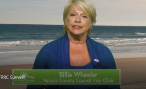
Click Here for Volusia County Council Vice Chair Billie Wheeler’s Video